Posts

Showing posts with the label #satellites

Important Innovations Collection: Launching Satellites From 747 Planes

Image
New Tech: Launching Satellites From 747 Aircraft Source:  Virgin Orbit Virgin Orbit's Air Launch System Richard Branson's Virgin Orbit just successfully tested its modified 747 aircraft - Cosmic Girl - that can fire off a rocket containing a satellite and place it in orbit.  The company is planning on its first commercial launch by the end of this summer.  For a great news blog, go to Important Innovations Collection: Launching Satellites From 747 Planes : Richard Branson's Virgin Orbit  Air Launch System Source:  Virgin Orbit's  747 with rocket under its wing Close to Commercial ...

Unusual Cloud Over North Pole

Image
Electric Blue Clouds Spotted by NASA AIM Spacecraft Source:  NASA Noctilucent Clouds Noctilucent Clouds At Extremely High Altitudes The image just released by NASA is spectacular.  They show Noctilucent clouds, which are clouds that appear in the very high atmosphere during twilight in the hour after sunset.  The clouds continue to reflect light even though the sun is below the horizon for those of us on the ground, Climate Change NASA says this rare phenomena has been increasing in the past ten years.  They add the likely cause is Climate Change which has increased the amount of water vapor in the atmosphere.  The new image, obtained by several satellite passes, shows reflectivity measurements gathered by NASA's Aeronomy on Ice in the Mesophere (AIM) spacecraft mission, as light from the clouds bounce back into space. Light Show From Space The season for Noctilucent clouds lasts from late May until August.  NASA explains that as the earth's lower atmosphere warm

Important Innovations Collection: Space Cybersecurity at Risk

Image
Satellites in Space in Danger of Hacking New Research by The Royal Institute of International Affairs New research by Chatham House or The Royal Institute of International Affairs warns that satellites in space are in danger of cyberattack.  They're calling for an immediate investment by NATO and NATO member nations to harden and protect their satellites as the military is dependent on them for data and communications particularly in conflict conditions.  For a detailed news blog, go to Important Innovations Collection: Space Cybersecurity at Risk : Satellites are Vulnerable to Hacking Source:  European Space Agency New Report from The Royal Institute of International Affairs UK...

Relativity to 3D Print Rockets

Image
NASA Leases the Start-Up Space Source:  Relativity Space Odyssey to Mars Relativity is a Los Angeles based, venture capital backed rocket maker.  It just leased 220,000 sq. feet of space at a NASA facility in Mississippi to 3D print low cost rockets to launch small payload satellites into orbit. Money for Mars One of the company's big goals is to manufacture rockets on Mars.  CEO Tim Ellis, who was an executive at Jeff Bezos' space company Blue Origin, says that is the first priority for space colonization. The company hopes to generate cash by using the Terran 1 rockets that it will 3D print in Mississippi to launch small satellites.  It will use the cash to develop a team of machine learning robots that can manufacture and assemble its Terran 1 rockets on Mars with no human help. Rocket Maker in Orbit The giant 3D printers on the ground in Mississippi can produce a rocket in under 60 days.  The Terran 1 is expected to launch in 2020 and will cost satellite maker

Airbus-DARPA Satellite Bus

Image
Constellations of Small Satellites Source:  Airbus Airbus Wins Blackjack Program Contract DARPA, the US Defense Department's Advanced Research Projects Agency, just awarded Airbus a contract to develop a satellite bus for its Blackjack program.  Blackjack is a satellite architecture for the US military.  Essentially, it is the utilization of constellations of small satellites in low orbit for the military. DARPA's New Small Satellite System DARPA plans on pairing the satellite buses with military sensors and payloads.  The buses will generate power for the satellites, provide propulsion and transmit spacecraft telemetry.  The use of small, inexpensive satellite constellations for military purposes is a concept DARPA has been developing over the past several years.  For more news stories on innovation, go to  amazon.com/author/ekane

China Sat for Global Internet & Broadband

Image
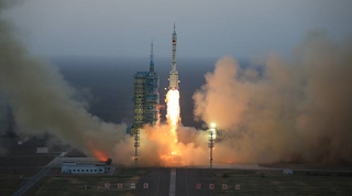
China's Space Based Communications Network Source:  China's  Satellite Launch  China Goes Broadband in Space It's called the Hongyun project.  It's space based, broadband communications innovation from China.  And, it's a first for them.  China's broadband delivering satellite is designed to provide broadband connectivity to users globally, especially in underserved regions. Bottom-line:  Global Competition on Breakthrough New Communications Innovation This is a concept of running a low-cost, high performance satellite network to provide space-based communications and internet services.  There are many innovation companies going for this opportunity including Google, SpaceX and Telesat. Space X CEO Elon Musk wants to put 12,000 satellites into orbit by 2020 to provide broadband and internet services globally.  It's his Starlink project. China's Launch China is a big competitor in this tech innovation race.  The Chinese Aerospace Science

India's Manned Space Mission 2021

Image
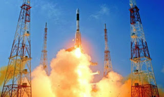
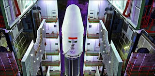
Great Leap Forward with Satellite Orbit Success Source:  ISRO Launch Photo Space Milestone India's communications satellite GSAT-29 now is in a geosynchronous orbit.  It was just launched today by ISRO's heavy lift rocket GSLV.  It went into orbit 16 minutes after it took flight.  It's a milestone for India's mission and ambitions in space. Bringing Advanced Communications to Rural Areas The satellite carries Ka and Ku based high communications transponders and is targeted at meeting the communications needs of people in remote areas of India such as Kashmir, Jammu and the northeastern parts of the country.  The satellite has a mission life of ten years. On Target for Manned Missions Today's success has reinforced India's belief they're on track for an unmanned space mission orbit in 2020 and a manned space mission in December 2021.

Countdown Underway for India's Space Shot

Image
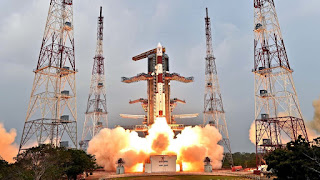
India Launching 2, UK Satellites India's PSLV rocket is about to launch into space 2 British commercial satellites. Blastoff is scheduled for today at Satish Dhawan Space Center in Sriharikota, India.  It underscores the growing importance of India in space for both exploration and commercialization. Earth Observation Satellites The UK vehicles are earth observation satellites.  They'll map ice melt, forests and land use. They'll also monitor disasters.  The satellites belong to Surrey Satellite Technologies of the UK.  Surrey made a commercial satellite launch arrangement with Antrix, the commercial unit of ISRO, India Space Research Organization. Satellites Focused on Global Ice Melt On Saturday, September 15, NASA launched ICESat-2, equipped with its most powerful laser.  The satellite's 3 year mission is also to measure and monitor the Earth's polar ice melt, ice sheets, glaciers and sea ice.

NASA's ICESat-2 Lifts-Off& In-Orbit

Image
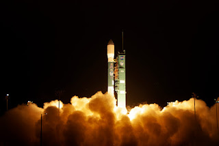
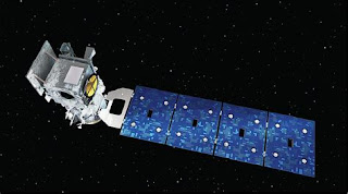
NASA Satellite Will Track Global Ice Melt Photo:  Courtesy of NASA ICESat-2 Global Ice Melt Tracker NASA launched its ICESat-2 satellite into space. The satellite contains NASA's most high powered laser.  It will provide unprecedented, highly valuable observations on how glaciers, ice sheets and sea ice are changing.  It will precisely measure the thickness of Earth's polar ice sheets, snow cover and permafrost. Bonus on Board A surprise bonus is also on board.  2 ELFIN CubeSats.  They're a pair of tiny satellites that will study how energetic electrons make their way from space to the earth's atmosphere. Measuring Ice and Melt ICESat-2's laser splits into 6 beams to precisely measure the Earth's polar ice formations.  The calculations are done by the amount of time it takes the laser beam to leave the satellite, hit and bounce off the ice and arrive back at the satellite. Massive Data & Important Climate Change Insights from this Mission T

India Ramps Up Global Space Program

Image
International Commercial Launches India's PSLV India in Space India's PSLV - Polar Satellite Launch Vehicle - is going to put into orbit 2, foreign satellites on September 16.  The satellites are both from the United Kingdom.  They are the NovaSAR and the S14.  The launch underscores India's growing importance in the exploration and commercialization of space. Innovation Hub India is a global force in breakthrough innovation and it's becoming a growing leader in the race to space.  It just finalized an agreement with France to partner on technology and space medicine for the manned space flights that India is planning. UK Launch and Mission The launch of the 2 satellites is for commercial purposes.  The satellites belong to Surry Satellite Technologies of the UK.  They are earth observation satellites.  Their mission in space is to map forests, land use and ice cover.  They will also monitor flooding and any other disasters.

Data from Satellites to the Cloud

Image
Geospatial Cloud Analytics Photo:  Courtesy of Descartes Labs - Fishing Boats off Singapore A New Mexico startup company Descartes Labs is receiving up to $7.2 million from the US government to bring geospatial data from satellites to the Cloud.   The volume of data is huge, in the terabytes, unwieldy and of the highest value. Descartes has been tasked by the government to use machine learning to process massive amounts of visual data from satellites. Images of Earth and Space Images of the Earth including heat imagery are available in massive volume from many satellites.  They contain rich and compelling information on such dynamic issues as changing global oil supplies, potential food shortages and climate change.  This is very big data from many sources that can't be fully capitalized on because it's not organized and centralized. Cloud Infrastructure Descartes Labs will build out cloud infrastructure to import, store, process and curate the data.  They'l

NASA Launches Sat Tracking Ice Melt Saturday

Image
Satellite will Provide Vital Information on Climate Change's Impact Image of NASA's ICESat-2 ICESat-2 NASA will launch its ICESat-2 satellite that will track the Earth's melting poles and disappearing sea ice on Saturday Sept. 15.  It will document how ice sheets, glaciers and sea ice are changing. And the information will help to generate new insights into how the changes are impacting people, animals and the environment.  The data also will be used to forecast conditions going forward. NASA's Most Advanced Laser ICESat-2 is NASA's most advanced laser instrument. It measures the height of glaciers and sea ice by precisely timing how long it takes individual photons to leave the satellite, bounce off the earth and return to the sat.  The laser beam splits into 6 beams to cover more ground.  The mission will last for 3 years.

Microsoft Co-founder Goes Big into Space

Image
Stratolaunch Space Ventures - 4 New Satellite Launch Vehicles Paul Allen's Space Innovation Fleet Space Service 2020 Microsoft co-founder Paul Allen's space company Stratolaunch is targeting growing demand for satellite launching vehicles.  He wants to make booking and getting into orbit on a satellite as easy as booking an airplane flight.  Sounds like the Microsoft way.  Stratolaunch just announced a fleet of 4 space vehicles:  a reusable space plane and 3 launch vehicles for satellites.  They expect to start space service in 2020. Capabilities Include World's Largest Plane as Launch Platform This system is proprietary and unique.  It will use the world's largest aircraft as a mobile launch platform.  It's capable of deploying launch vehicles to carry satellites to multiple orbits and inclinations on a single mission. More Details The vehicles just detailed by Allen's company include the space plane, the Pegasus (access into orbit with 35 success

India in Orbit - Manned Spaceflights in 2022

Image
France Partners with India to Explore Space India's Space Launch Planned for 2022 Gaganyaan 2022 France has announced its intention to work with India on India's planned manned missions to space starting in 2022.  The Indian space mission is called "Gaganyaan" for 2022. French Innovation Expertise for Space France is offering to provide a wide range of innovation expertise.  The areas include space medicine, astronaut health monitoring, astronaut life support and space debris & radiation protection.  France has already developed these technologies for manned space missions. Indo-French Cooperation in Space The Indo-French cooperation is across the fields of Climate Change, joint groups working on future launch vehicles and deep space exploration with the French contributing to India's future missions to Mars and Venus. Unique, International Cooperation  It's a unique, multitiered international partnership designed to support and forward In

Satellite Bodyguards - Star Wars

Image
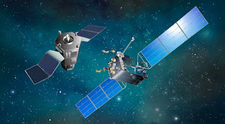
DARPA's Satellite Servicing System RSGS Satellite Bodyguards The US Defense Department's Advanced Research Projects Agency DARPA is developing a robotic system to service satellites in geosynchronous orbit (RSGS).  Besides doing refuels, repairs and other services, RSGS is also designed to protect vital US satellites against adversaries' robotic systems used as antisatellite weapons.  RSGS is a satellite bodyguard system against space threats. Satellite Stalking Threat By early 2020, Russia and China will have robotic systems in geosynchronous (G) orbit.  Satellites in G-orbit are difficult to reach by other types of antisatellite weapons.  Experts are warning of a growing threat in space of satellite stalking. US Budget Issues The US Air Force wants to launch the US RSGS system in March 2021,  The US Senate just cut the $209 million in launch money from the USAF budget.  As Russia and China ramp up their systems, experts are warning of growing, US satellite v

World's 1st Wind Mapping Satellite

Image
European Satellite to Improve Global Weather Forecasts Source:  European Space Agency - Aeolus  Aeolus the Wind Chaser The European Space Agency has just launched the world's first wind mapping satellite.  It's called Aeolus.  It's the first to measure wind direction and speeds all over the world. Better Weather Aeolus'  global wind tracking will allow scientists to provide better worldwide weather forecasts.  This is the 1st time global wind speeds and directions have been monitored 24/7 from space. Blowing in the Wind Until now data on air movement has been gathered largely from the ground or indirectly thru observations from planes or space.  Aeolus is equipped with lidar that sends powerful ultraviolet laser light into the atmosphere.  It then observes which way the light scatters when they bounce off tiny particles in the air.  By comparing wavelengths of the light when it goes out and returns, scientists can determine which way the winds are blowing.