NASA to Track Earth's Ice Melt
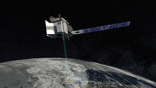
Satellite with Most Advanced Laser Altimeter to Track Global Ice Melt ICESAT-2 In mid-September, NASA will launch ICESAT-2. It's a $1 billion satellite loaded with the most advanced laser system NASA has ever launched into space. The purpose is to track and precisely document how the earth's ice sheets, sea ice and glaciers are melting. NASA officials think more than 2/3rds of the earth's ice has melted since the 1980's. Ice Mission ICESAT-2 is going to provide an unprecedented level of detail and precision on how ice sheets' heights and thickness are changing. It's a 3 year mission and the highly advanced laser onboard adds the 3rd dimension to the measuring. The system is so precise it can document increases and decreases in ice thickness as small as 1/5 of an inch. "Revolutionary" Technology NASA says this instrument is "revolutionary" to study both land and sea ice. The laser beam splits into 6 beams and fires 10,00...